Case Study
York River/Gloucester County, VA: Balancing Conflicting Uses Through Stakeholder Engagement
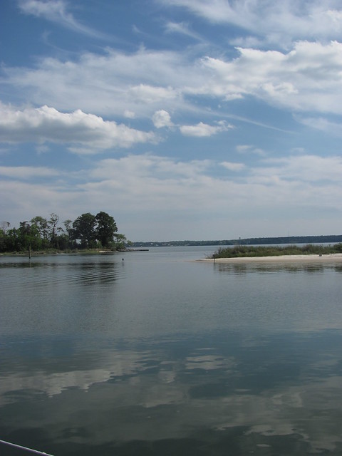
Location
York River/Gloucester County, VA
Timeframe
2008 – present
Summary
On the York River, conflicts are becoming increasingly common between waterfront property owners, recreational and commercial boaters, aquaculture industries and others seeking to use the Commonwealth’s water resources. The historical balance between working waterfronts and residential development is shifting to a waterfront that is predominantly residential. Infrastructure to support working waterfronts and the economic opportunities they provide is disappearing. As the Middle Peninsula of Virginia continues to transition from a rural community to a suburban one, public policies governing near-shore land, public water bodies, and water use rights/privileges must adapt. The York River Use Conflict Committee was established to explore the public policy question facing many rural coastal local governments: “To what extent will future development of coastal communities rely on the opportunities presented by a coastal environment, and what public policies will govern such opportunities?”[1]
Transferability
The York River Use Conflict Committee undertook a public participation process which is transferable to other communities facing similar conflicts. Stakeholder education and participation, GIS analysis and inventory, jurisdictional authority analysis and development of common terminology are all transferable tools. Finally, the “Use Conflict Report and Recommendations” prioritized conflicts and included policy recommendations that are potentially transferable to other communities.
Best Practices
Engaging stakeholders and helping them understand others’ perspectives and interests is key. Analysis of jurisdictional authority and development of common terminology are also important. The no-net-loss of working waterfronts policy that was recommended in the Use Conflict Report has been implemented by Gloucester County.
Full Case Study Description
Background
The active, but diminishing, commercial fishing industry faces competition for waterfront space. Waterfront privatization, conversion of water-dependent uses to non-water-dependent uses, and dramatic increases in waterfront property values have only exacerbated the problem.
History
The region has a long history of fishing and agriculture. The primary use conflict discussed by the Committee was aquaculture, particularly the growing of oysters in metal cages placed in the riparian zone.
Local Context
The York River is a navigable estuary approximately 34 miles long in the eastern part of Virginia. Ranging from 1 to 2.5 miles wide, its watershed drains an area including portions of 17 counties of the coastal plain north and east of Richmond. Gloucester County, Virginia, is located in the Middle Peninsula region, bordered by the York River and the lower Chesapeake Bay. Despite the rural aspects, Gloucester County is part of a growing metropolis within the Hampton Roads metropolitan area.
Challenges & Issues
The largest challenge facing local governments is balancing the needs and expectations of upland property owners against the loss of a coastal maritime identity and the working waterfront infrastructure. Such infrastructure includes commercial marinas, boatyards, wet and dry storage, fish houses, commercial fishing dockage, and marine-related industries such as boat dealers, boat repair and maintenance services, commercial fishing and tourism. The current trend is towards non-water-dependent uses (residential development and condominiums) and exclusive use (private marinas).
The 2006 Board of Commissioners of the Middle Peninsula Planning District Commission (MPPDC) concluded that water use conflict was among the area’s highest legislative and policy priorities. To gain a better understanding of existing uses and conflicts along the York River, the MPPDC established the York River Use Conflict Committee and selected Gloucester County for the Conflict study. MPPDC staff and the Gloucester County Board of Supervisors appointed Committee members representing various use conflict perspectives. The Use Conflict Committee members represented a diversity of interests and backgrounds. Committee membership included:
- Local elected official
- Local planning staff
- Residential waterfront property owners
- Commercial waterfront property owners
- Commercial fisherman, oyster harvester, clam harvester
- Recreational users (duck hunting, oyster gardening, crab harvesting, fishing, boating)
- Staff resource experts
Actions Taken
The Committee was charged with:
- Determining the features and uses as they currently and historically existed;
- Identifying what conflicts exist or could exist in the study area;
- Determining what is or could be causing the conflicts;
- Discussing how conflicts could be mitigated; and
- Recommending public policy that could manage the conflicts.
Approaches Used
To initiate the process, the MPPDC and Virginia Sea Grant (with NOAA, funding from the Virginia Coastal Zone Management Program in the Virginia Department of Environmental Quality) sponsored a forum to provide an opportunity for the public to discuss sources and locations of use conflict important to residents. Information collected at the public forum was then used as a foundation for the work of the York River Use Conflict Committee.
This Planning Effort can be broken down into four PHASES:
- Phase 1 – Virginia Sea Grant GIS Analysis of study area and outreach.
- Phase 2 – Virginia Coastal Zone Management Program Funded: Learning phase for committee members; dispel myths and notions about water use conflict.
- Phase 3 – Virginia Coastal Zone Management Program Funded: Use conflict issue framing and policy need identification.
- Phase 4 – Virginia Coastal Zone Management Program Funded: The final project analysis and final report used to drive future development of enforceable policies.
Common Understanding
It was important for the Use Conflict Committee to develop a common understanding of issues, including existing policies, regulations and terminology. Within the riparian zone, multi-jurisdictional overlap is common. A comprehensive compilation of existing state and local codes and agency regulations, as well as jurisdictional illustrations, were critical to educating the Committee members. Through facilitated meetings, homework assignments and field trips, the Committee gained significant understanding of these issues and of other stakeholders’ perspectives and interests.
Policy Framework
Underlying State and local laws and regulations regarding the Commonwealth’s waterways is the Public Trust Doctrine. It holds that certain resources are preserved for public use, and that the government is required to maintain them for the public’s reasonable use. Virginia Code Section 28.2-1205 states that the Virginia Marine Resources Commission (VMRC) must consider the public trust doctrineand the Virginia Constitution when making decisions regarding the Commonwealth’s bottom or submerged lands. VMRC must balance the various public uses, which often conflict with one another.
Accomplishments
The Use Conflict Committee employed two processes for prioritizing conflicts. The first process involved analyzing the relationships between local, state and federal jurisdiction and various combinations of use categories: commercial and residential uses; recreational and residential uses, and commercial and recreational uses. A second process utilized a matrix to identify the use conflict “issue area” and then presented two perspectives: one in favor of the use and the other in opposition. Committee members were then asked, “What should local governments do about the conflict?” Each Committee member was asked to prioritize the importance of the conflict and assign a priority for addressing the conflict. The results served as a foundation for understanding how local governments might handle conflict and prioritize conflict issues.
GIS Analysis
Virginia Sea Grant funded a Geographic Information System (GIS) Analysis of the study area in Gloucester County. The GIS project assembled spatial data related to a number of topics, including water dependent uses, agency jurisdiction, current regulations regarding use standards and zoning of waterways, existing and proposed infrastructure, and sensitive and significant habitats, such as wetlands and shellfish areas. The Use Conflict Committee worked in small groups to analyze the resulting Study Reach GIS plates. Each group used a conflict worksheet to analyze spatial information and better understand each part of the Study Reach, such as perspectives on use from the landside and waterside.
Education
Education has been an important component, and the Committee’s discussion of key questions, including: “Who should manage use conflict?” “What is the appropriate use?” and “Who should determine the appropriate uses?” Photographs of different recreational, commercial, and residential uses were provided for this discussion, and use conflict regulations from other states were discussed. In the end, the Committee created a matrix of all identified use conflicts and the responsible managing entities. This matrix provided an overview of the Committee’s education phase that helped inform its work transitioning to policy recommendations.
Next Steps
On February 17, 2009, the Gloucester County Board of Supervisors approved all recommendations from the York River Use Conflict Study. Various Gloucester County department heads were assigned implementation responsibilities. Many of the recommendations from the York River Use Conflict Report have been implemented in adjoining localities struggling with balancing uses in the coastal zone.
Key Partners
- Middle Peninsula Planning District Commission
- Virginia Sea Grant
- Virginia Coastal Zone Management Program
- NOAA
- Local Stakeholders
Contacts
Lewis Lawrence
Executive Director, Middle Peninsula Planning District Commission
P.O. Box 286
Saluda, VA 23149-0286
(804) 758-2311
Email: LLawrence@mppdc.com
Website: Middle Peninsula Planning District Commission (www.mppdc.com)
References
The York River Use Conflict Report: York River Use Conflict Report (www mppdc.com/index.php/service-centers/coastal/york-river-use-conflict)
Last updated 19-Mar-13